The map is not the territory
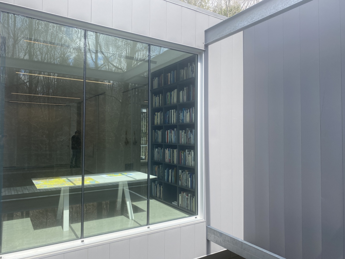
From May 4th to June 9th 2024 grantham Foundation, Québec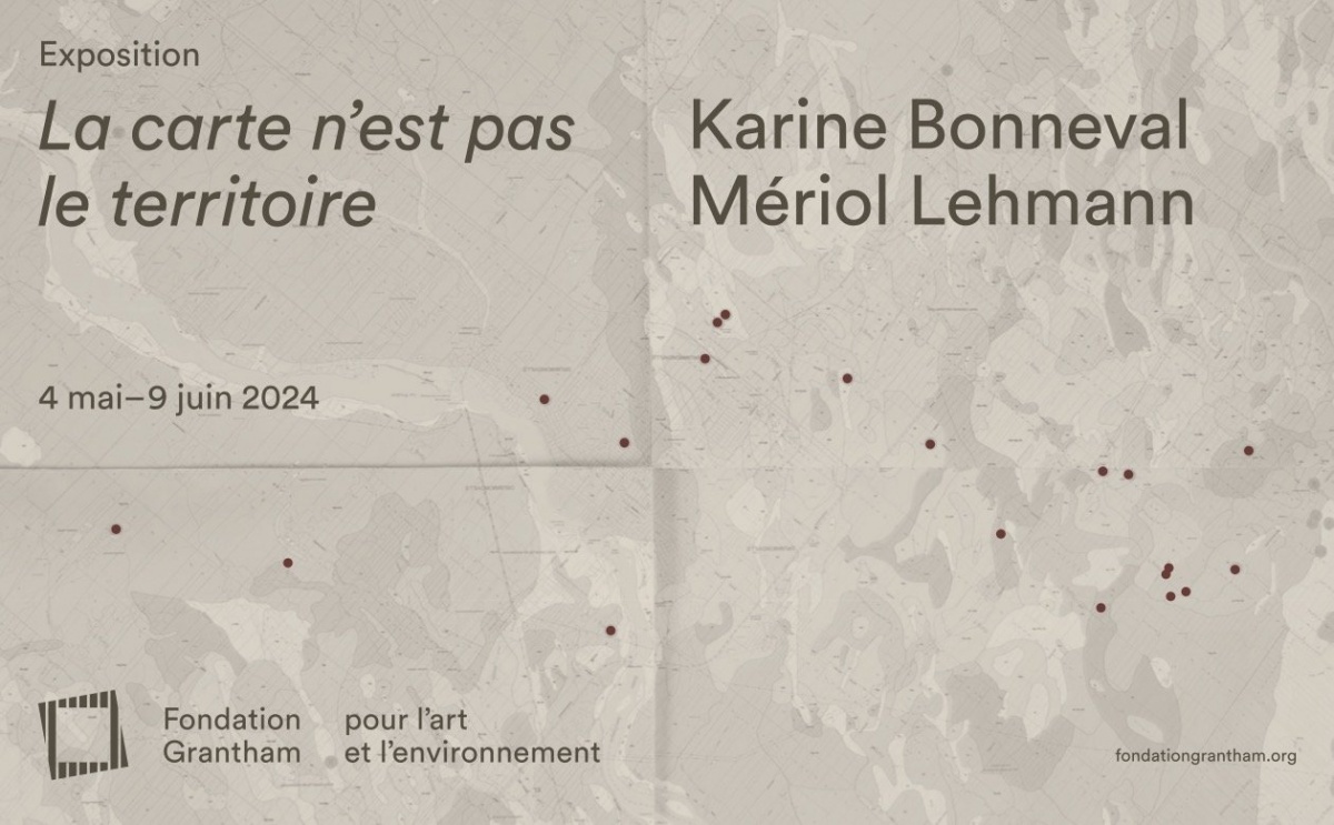
La carte n'est pas le territoire invites us to consider the ground as a lived space. Each of the two installations in the exhibition attempts to bridge the gap between cartographic tools, which abstractly dissect and synthesise environments, and the extraordinary richness of ecosystems. Formulated in the 1930s by the philosopher Alfred Korzybski, the aphorism that gives the exhibition its title expresses this distance between the representation of the world and reality.
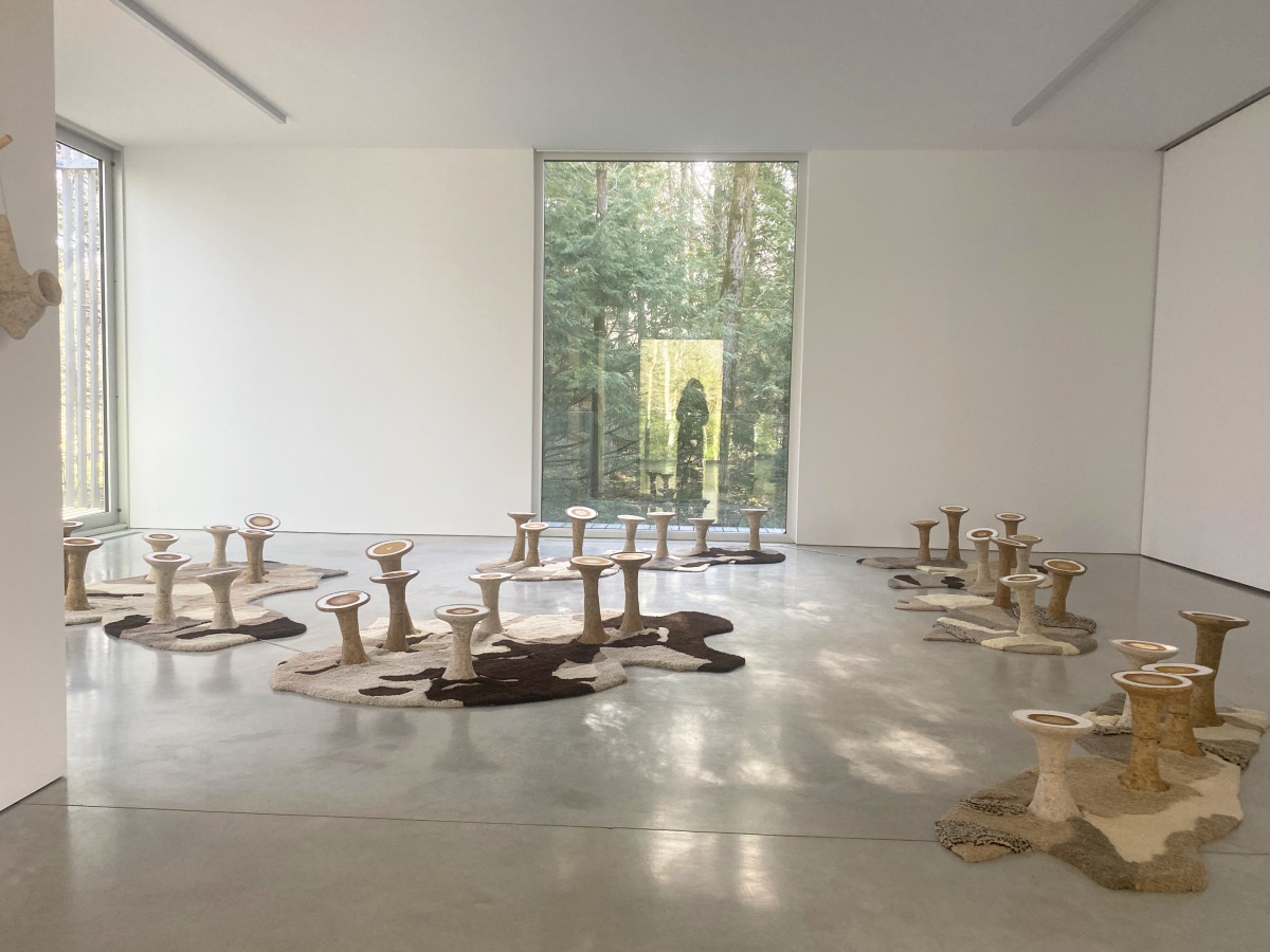
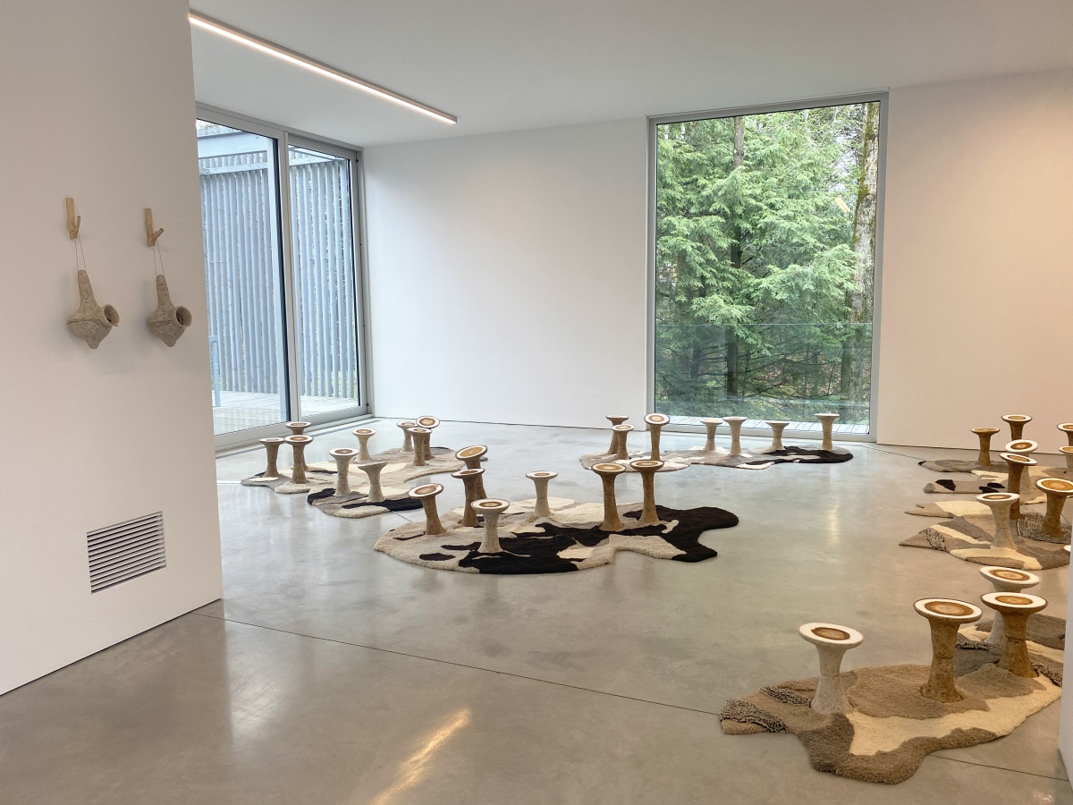
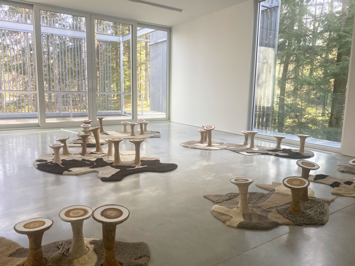
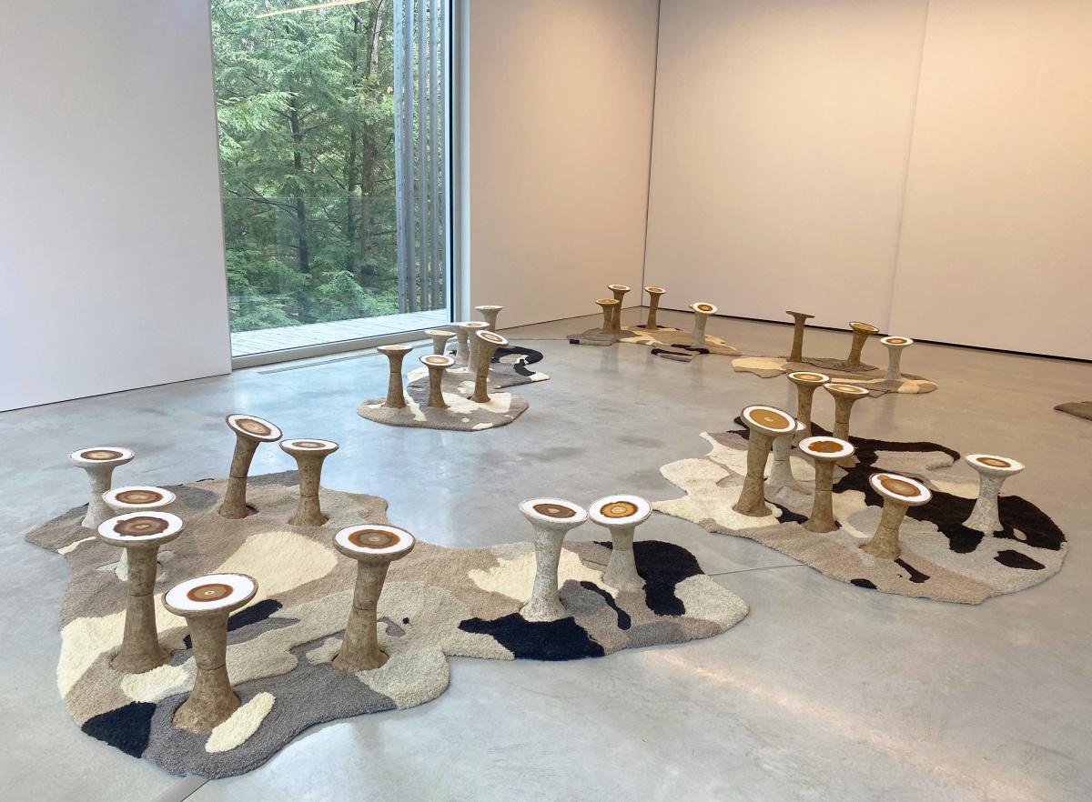
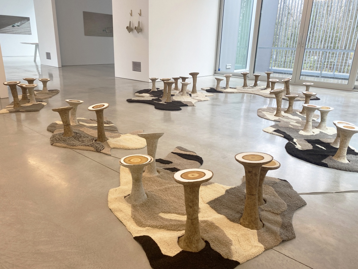
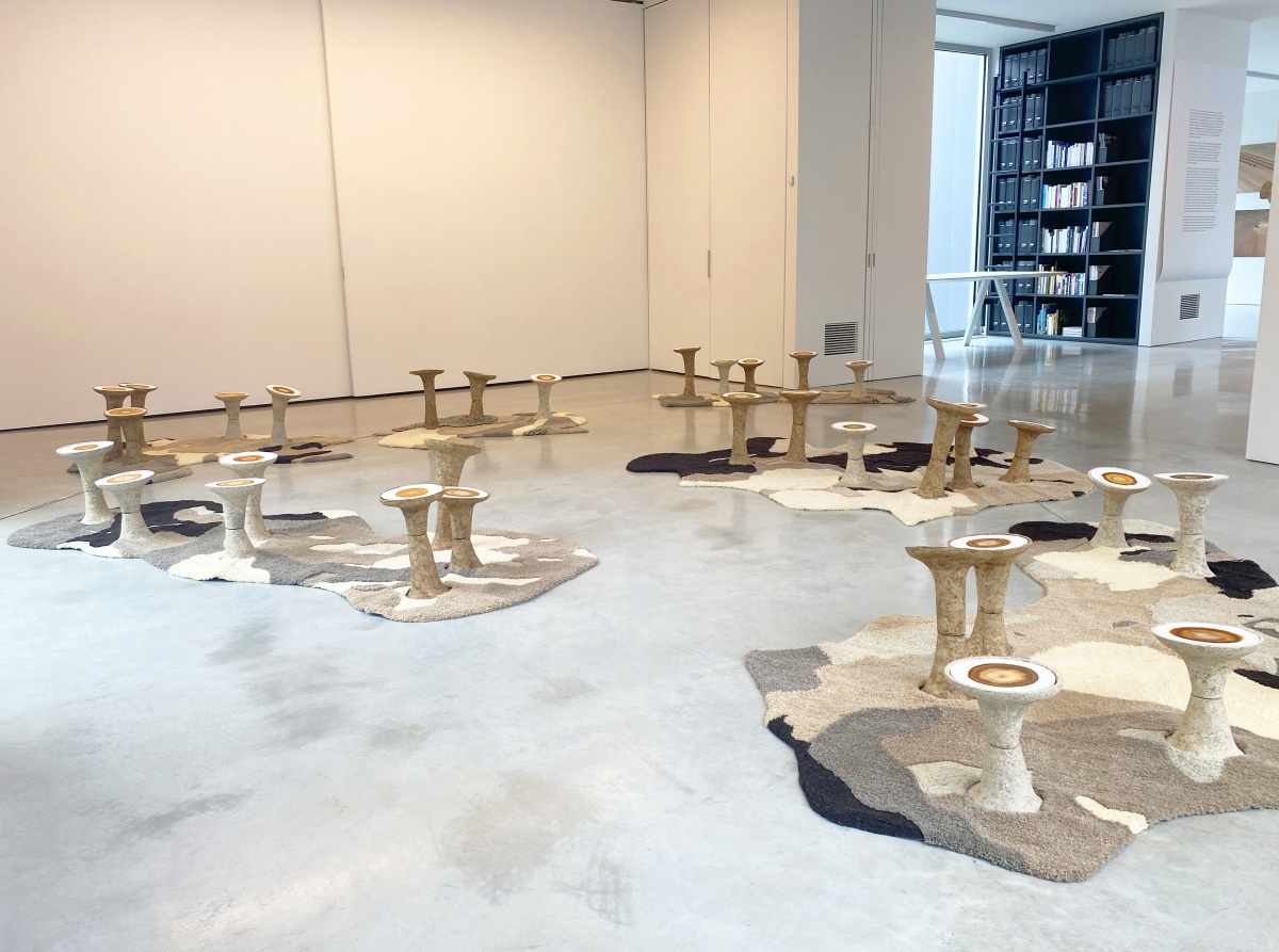
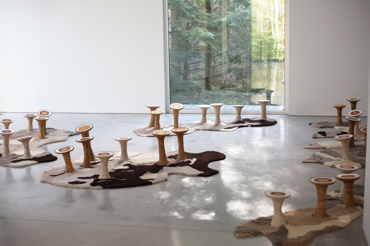
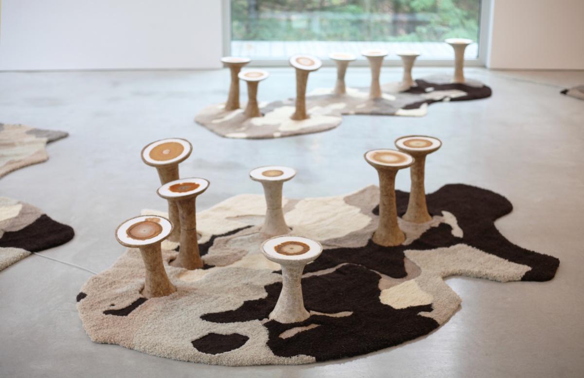
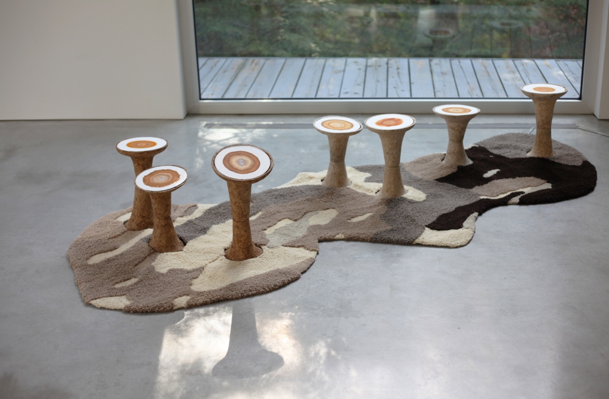
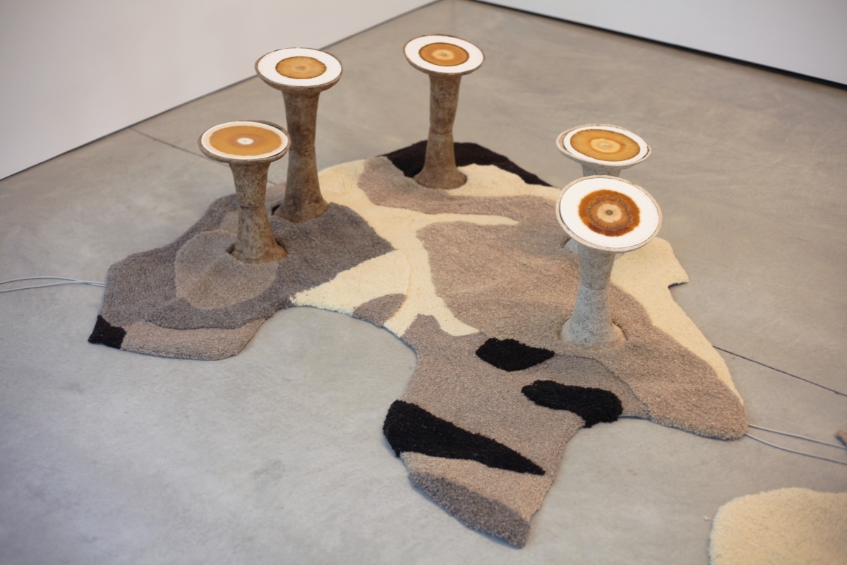
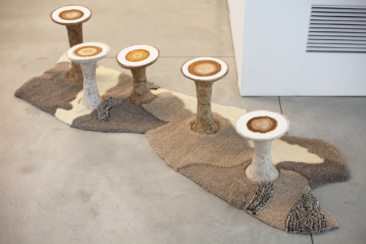
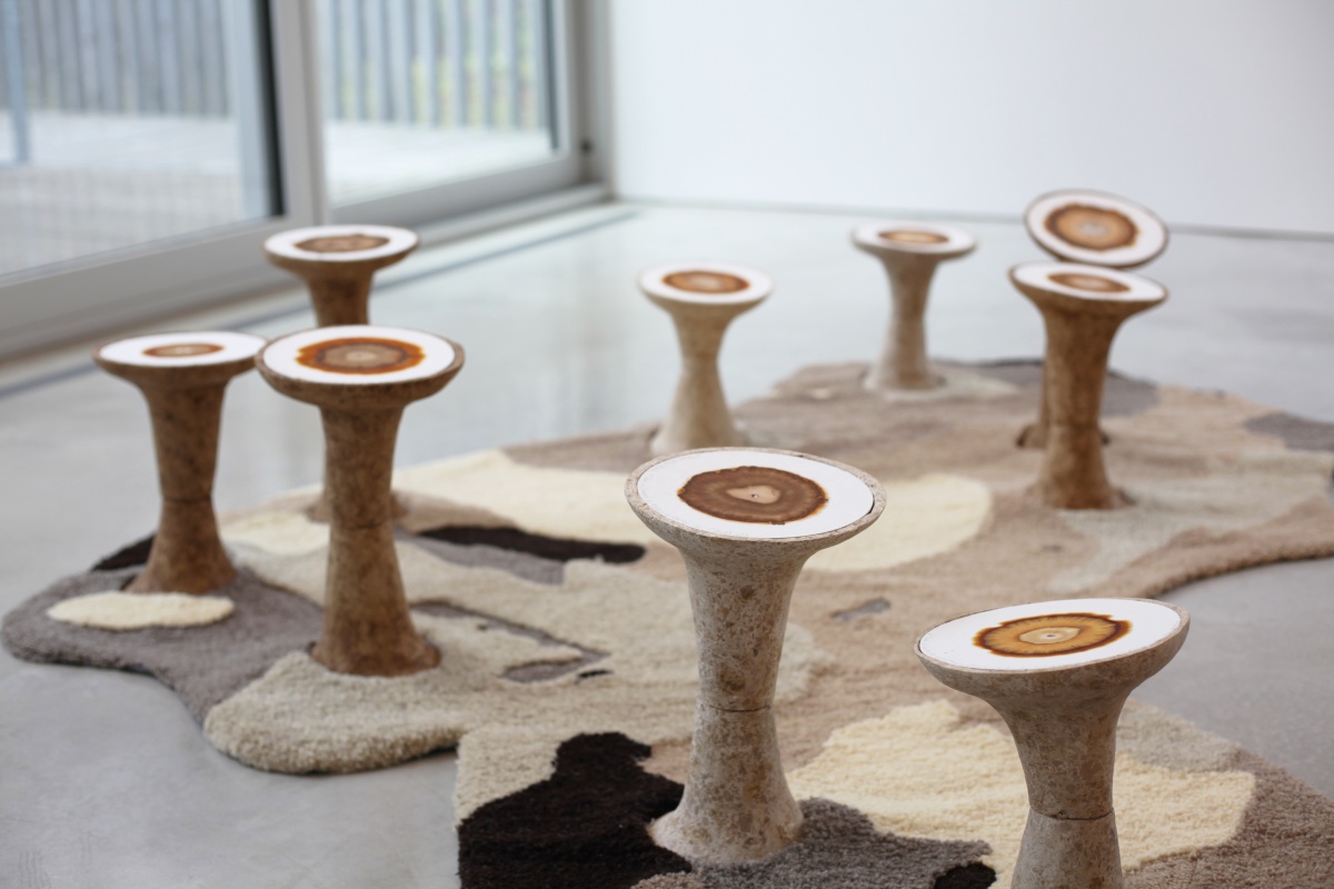
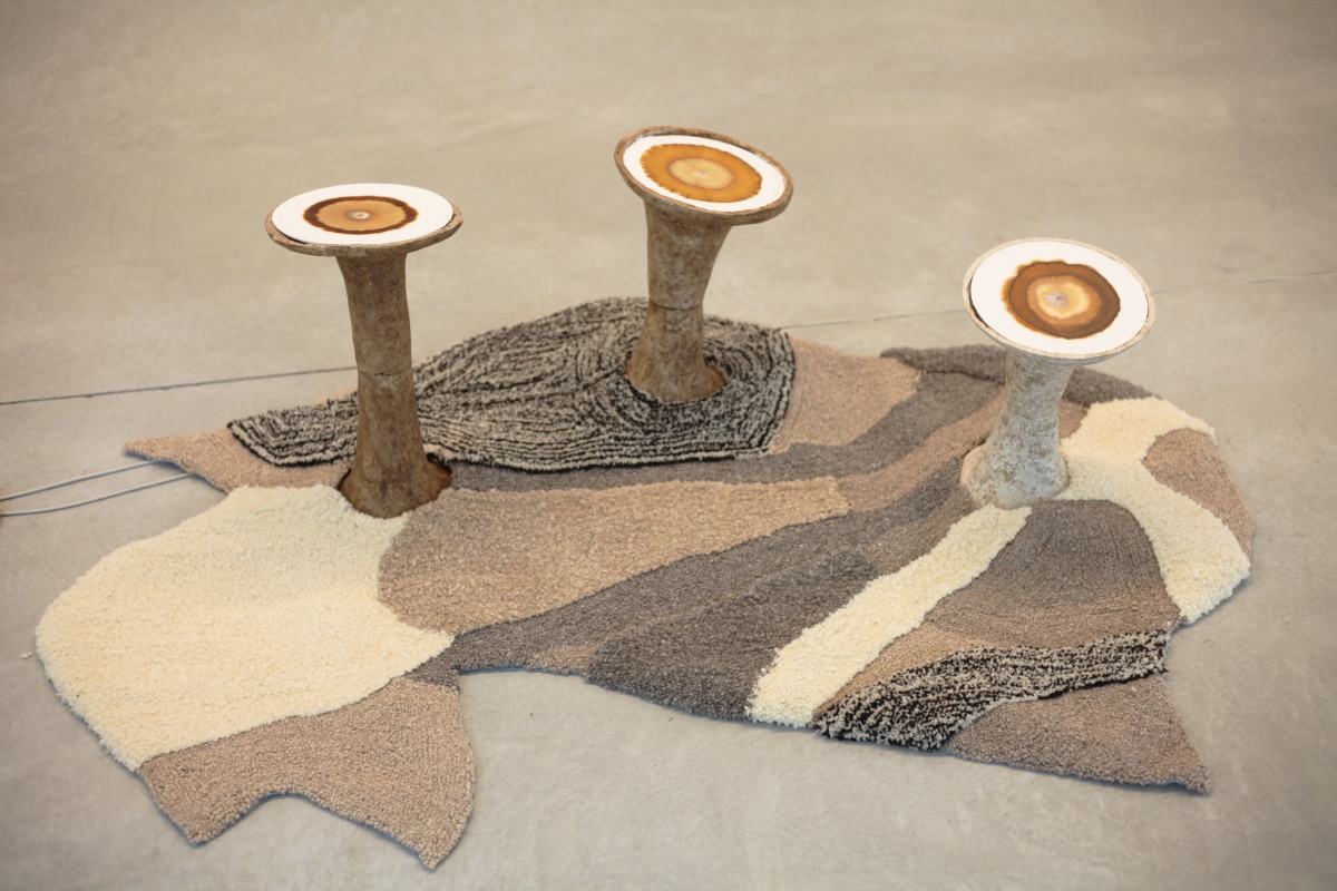
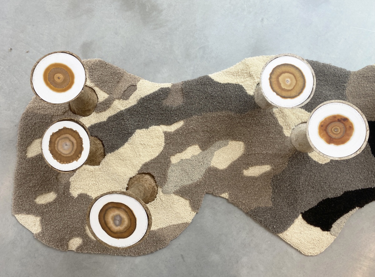
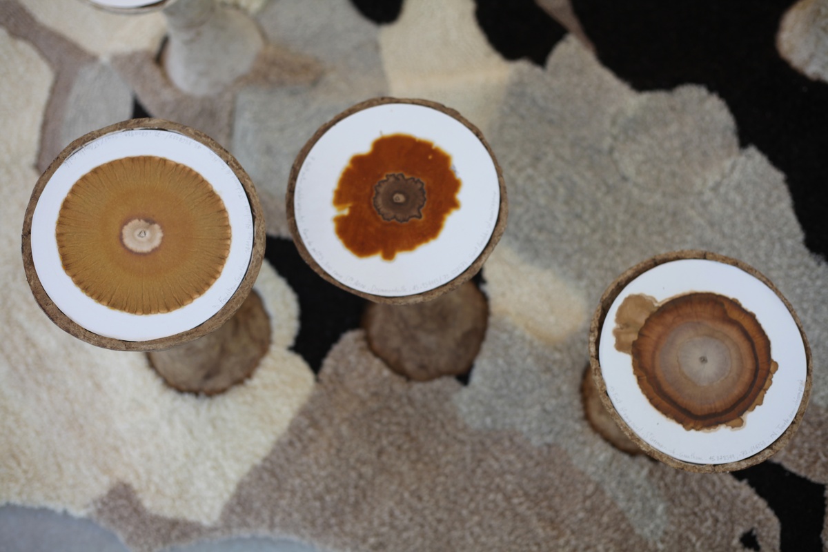
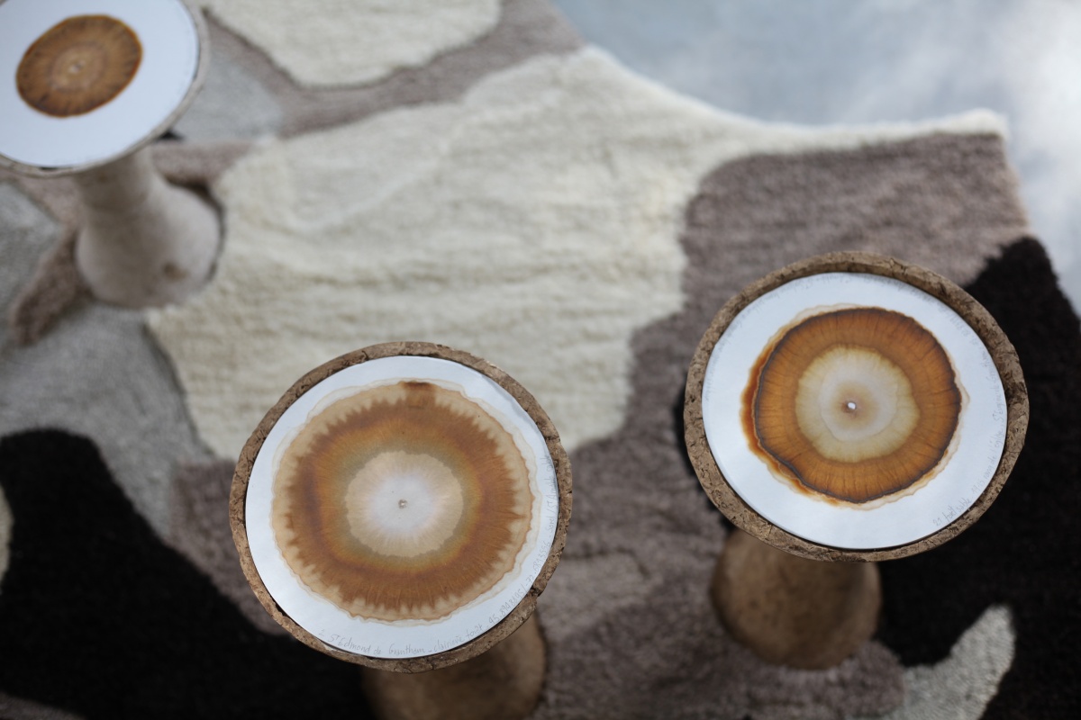
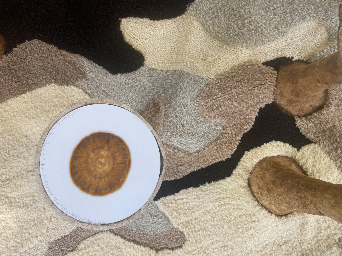
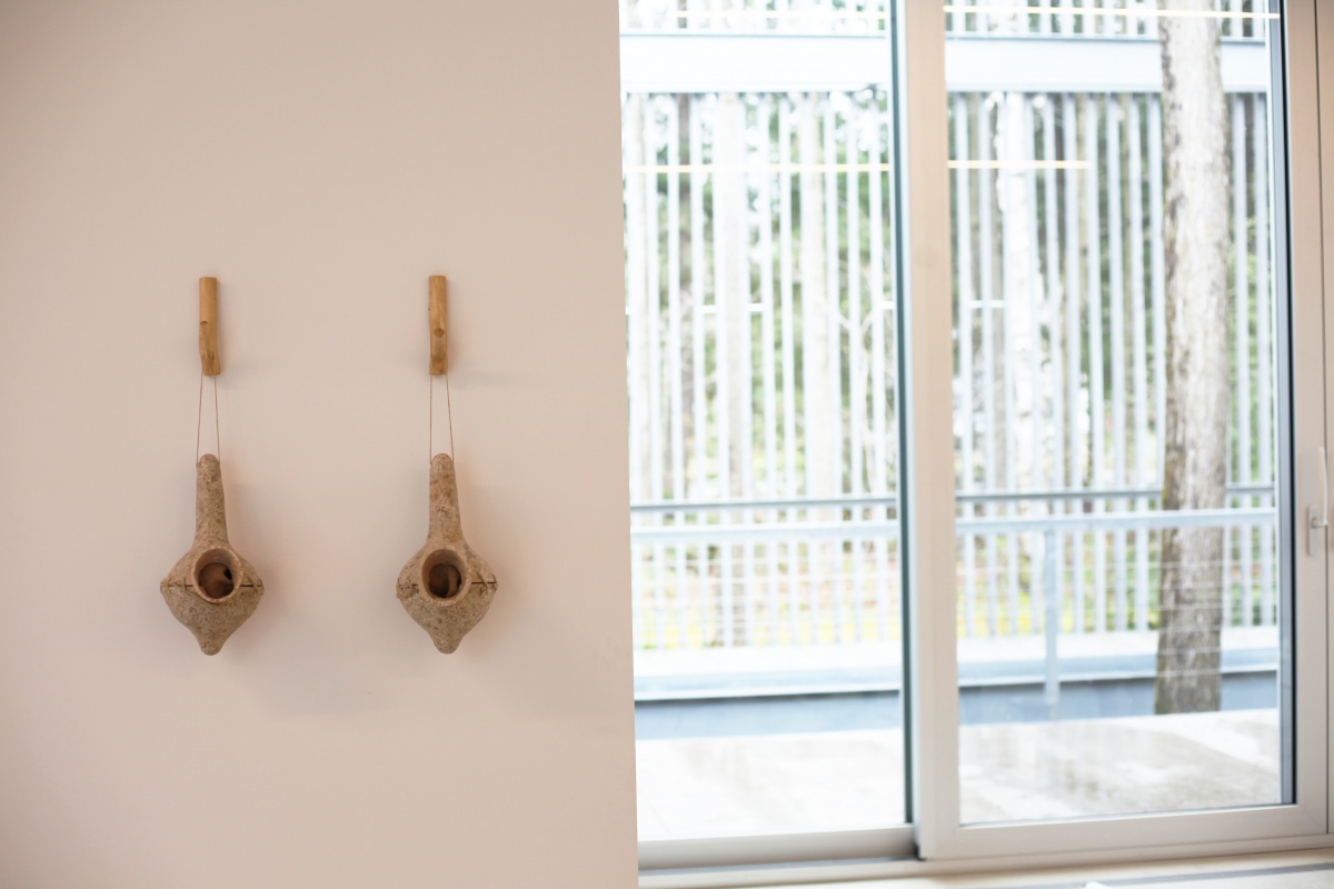
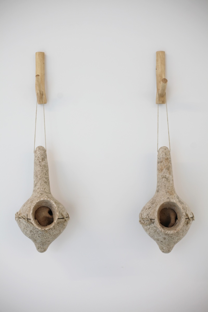
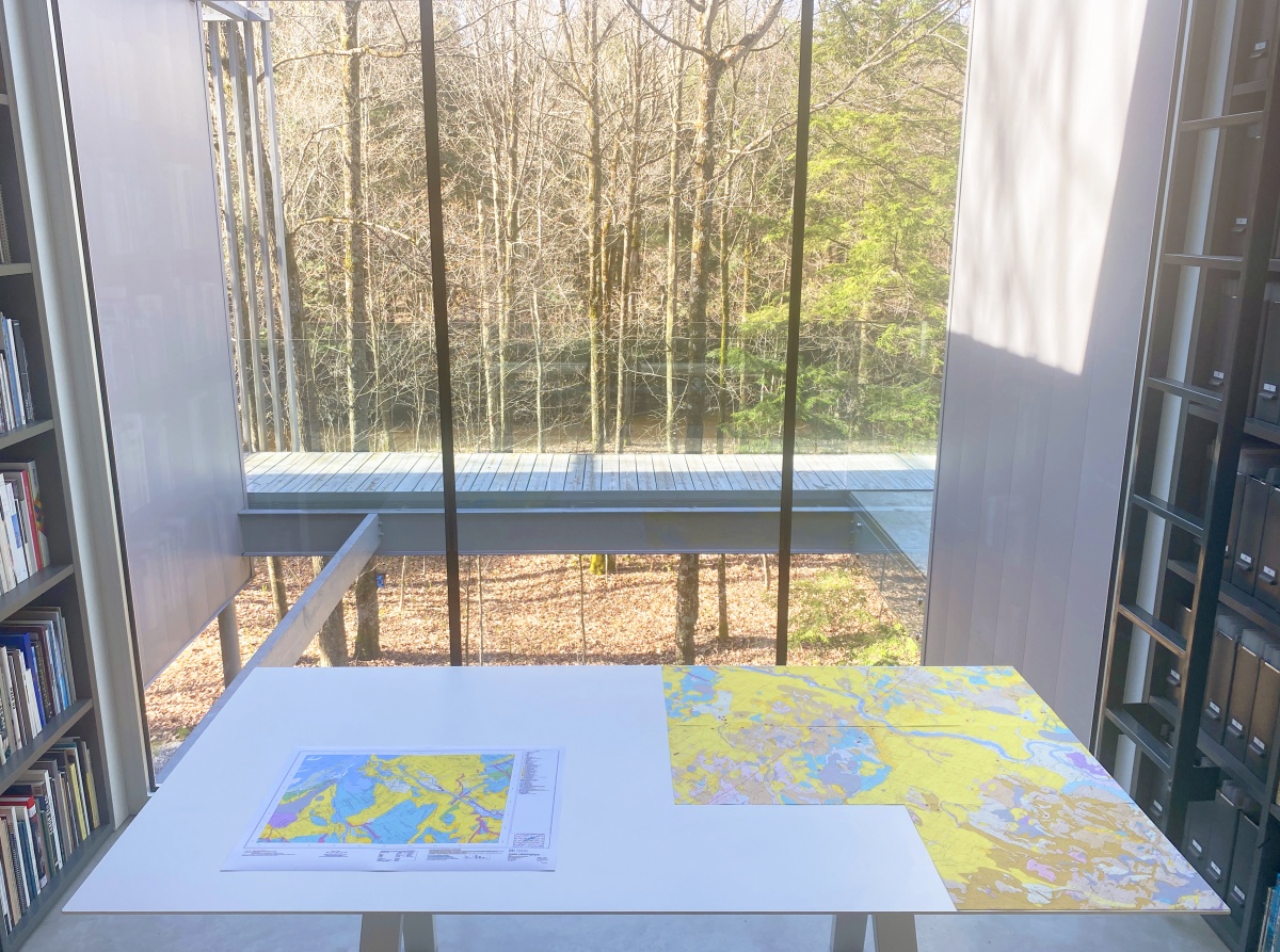
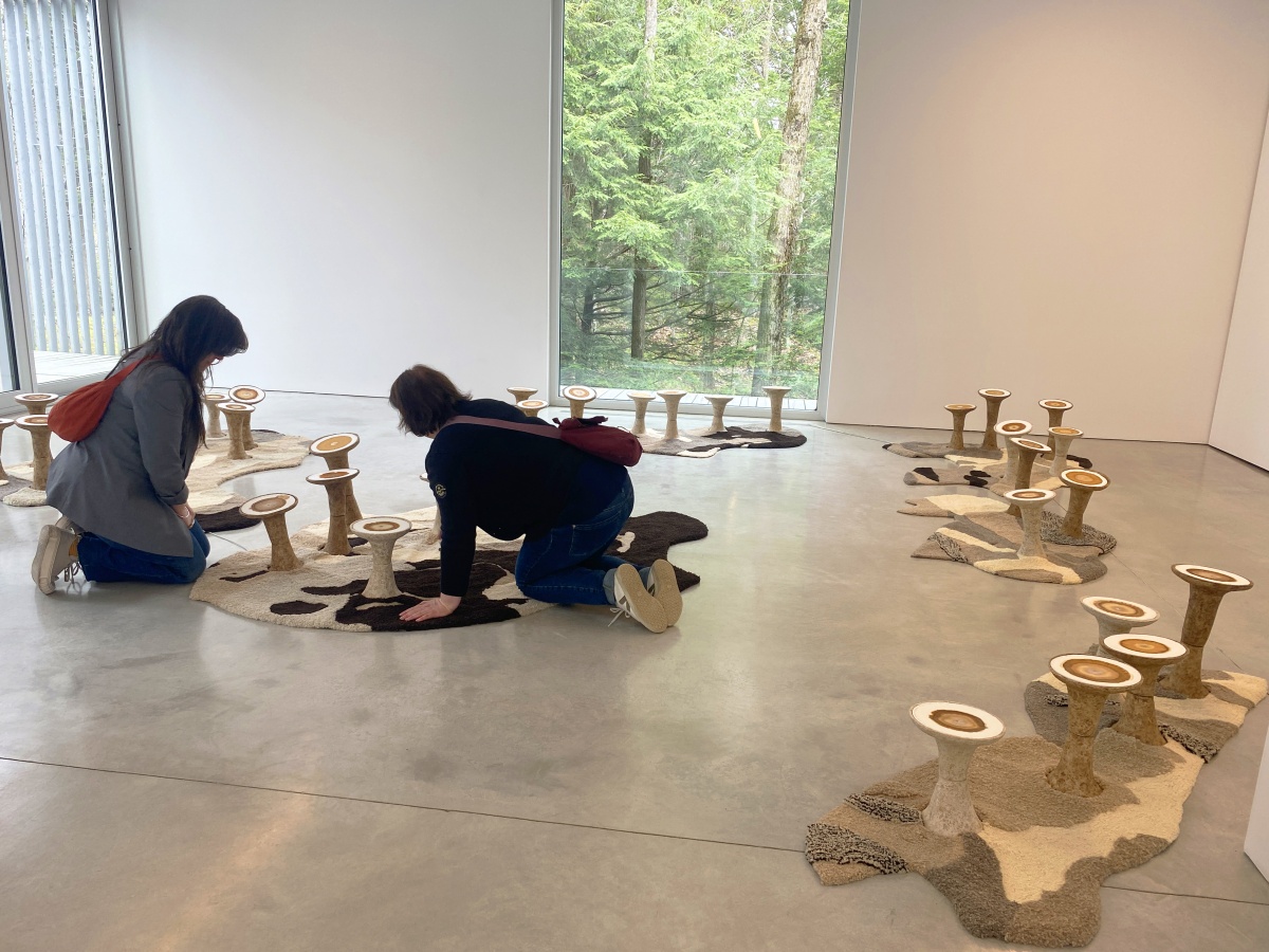
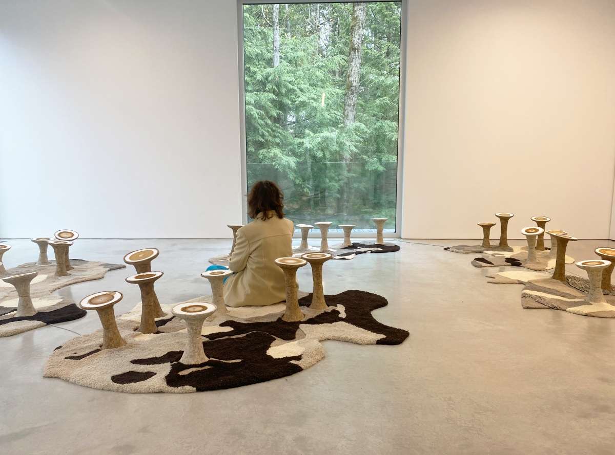
The sound installation Toucher terre, by Karine Bonneval, invites us to listen to the ground. The patterns of the six natural wool carpets laid out in the space are inspired by the soil maps of the Centre-du-Québec region, whose function is to reveal the subterranean composition of the land. Made audible by a custom-made contact sensor, the resonance of the sand is distinct from that of the peat or black earth inhabited by different living organisms. In the room, each mat broadcasts field recordings made within the same biotope: forests, riverbanks, gardens, food crops, meadows and fields. The mats also present visual 'portraits' of these soils, obtained using the principle of chromatography. In Toucher terre, the map becomes soft, warm and welcoming. It invites us to lie down and discover what otherwise eludes us.
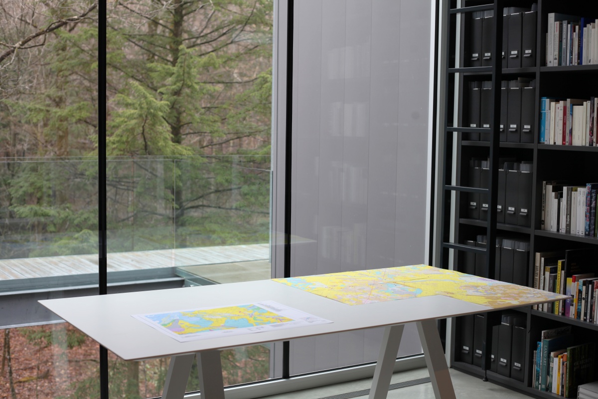
Mériol Lehmann's photographic installation Dust rises from our fields (2024) looks at the erosion of arable soil in the St Lawrence Lowlands. The images captured from the sky all show machinery at work, but it is the environment they are sowing and ploughing that is the real subject. Lehmann has been visiting these seemingly endless fields for several years. In addition to the title of each of the photographs, reddish satellite maps provide clues as to where they were taken. We shouldn't be surprised that they are pixelated, since it is not a clear 'image' of the soil that they are intended to convey, but a quantity of information - data - about its productivity. In other words, they are not aimed at the human eye, but at other machines.
While the historical development of cartography is increasingly seen by researchers as a tool of appropriation whose effectiveness was based on the erasure of pre-existing living relationships, the works of Bonneval and Lehmann underline in a clever reversal that the territory is infinitely more complex than the map shows. The dialogue between the two installations on the fragile ecology of soils gives rise to a renewed concern for the life that unfolds beneath our feet, out of sight.
Josianne Poirier, exhibition curator